The chart briefs itself: every free-flight start, named and described b3f29f5
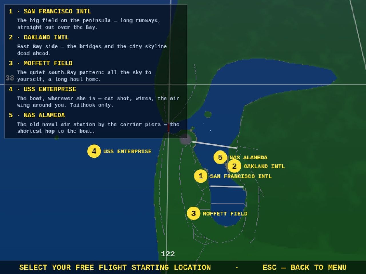
The free-flight map used to give you five yellow numbers and wish you luck — fine if you grew up on the Bay, less fine if you just wanted to know which dot was the boat. The chart now briefs:
- Every marker wears its name. SAN FRANCISCO INTL, OAKLAND INTL, MOFFETT FIELD, USS ENTERPRISE, NAS ALAMEDA — the field’s title rides beside its number, flipping sides near the screen edge so it never clips.
- A legend panel with one-line briefs. What each start is good for: SFO’s long runways, Oakland’s view of the bridges, Moffett’s empty south-Bay pattern, Alameda as the shortest hop to the piers — and the Enterprise flagged plainly as cat shot, wires, and tailhook only, so the USAF-jet surprise on the next screen is no longer a surprise.
The numbers still pick the spot, ESC still steps back — the map just finally tells you where you’re going before you go.